Mapping
Drone mapping and orthomosaics in New Jersey.
Your whole site as one current, measurable, shareable map: orthomosaics, elevation models, stockpile volumes, and 3D site models from a single drone flight. Explore a live example below.
Sharper and more current than satellite imagery
Public satellite imagery of a New Jersey parcel is often a year or more old and too soft to work from. A drone orthomosaic is flown on your schedule and shows the site as it stands that day, sharp enough to see pavement cracks and individual pieces of equipment. Every pixel sits at a real-world coordinate, so distances and areas can be measured directly on the map.
We map one-acre commercial lots, active construction sites, storage yards, and industrial terminals for developers, civil engineers, builders, facility managers, and solar installers across all 21 counties.
What one mapping flight can produce
Orthomosaic site maps
One seamless, true-to-scale aerial map of the property, with distances and areas measurable on screen. The foundation of every mapping job.
Stockpile volumes
Cubic yards per pile, and tons using your material's density, measured without climbing piles or shutting down the yard.
Elevation and contours
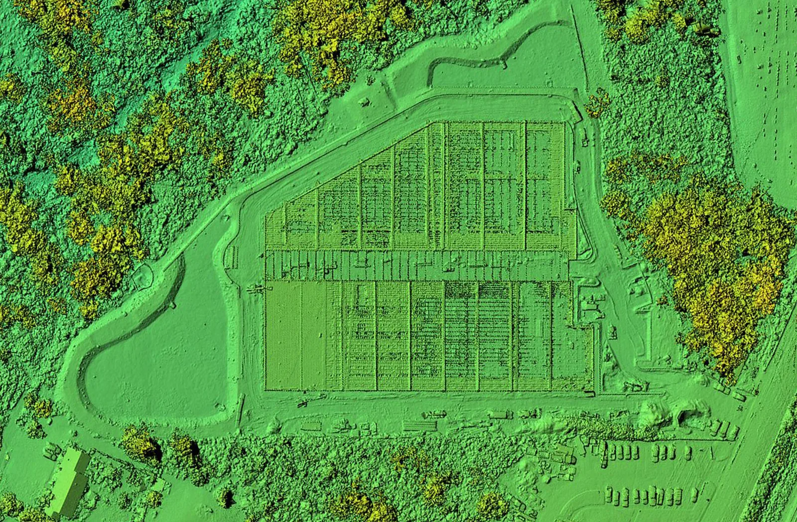
Surface and terrain models, DXF and SHP contours for CAD, and color-coded views that show drainage and grading at a glance.
Recurring progress maps
The same grid flown on a schedule gives you a dated, comparable record of the build from groundbreaking to completion; see construction progress programs.
3D site models
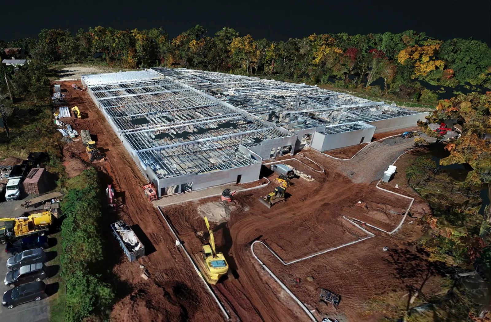
A textured, interactive model of the property that anyone can orbit and inspect in a browser, without visiting the site.
Marketing aerials
The drone is already in the air, so the same visit can cover listing, leasing, and lender-update photos as well as the measurable record.
Explore a live drone map: Hillsborough, NJ
This is the actual orthomosaic from an October 2026 mapping flight over a self-storage facility under construction in the Belle Mead section of Hillsborough Township, Somerset County. Click the map to activate it, then zoom from the full site down to individual equipment and material staging. Use Measure for distances and areas, Elevation to switch to the color-coded surface model, and the fullscreen button for the full effect.
The detail a project team actually gets
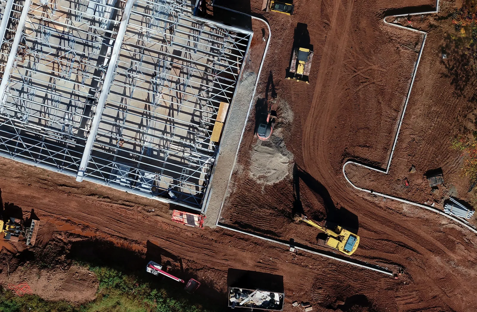
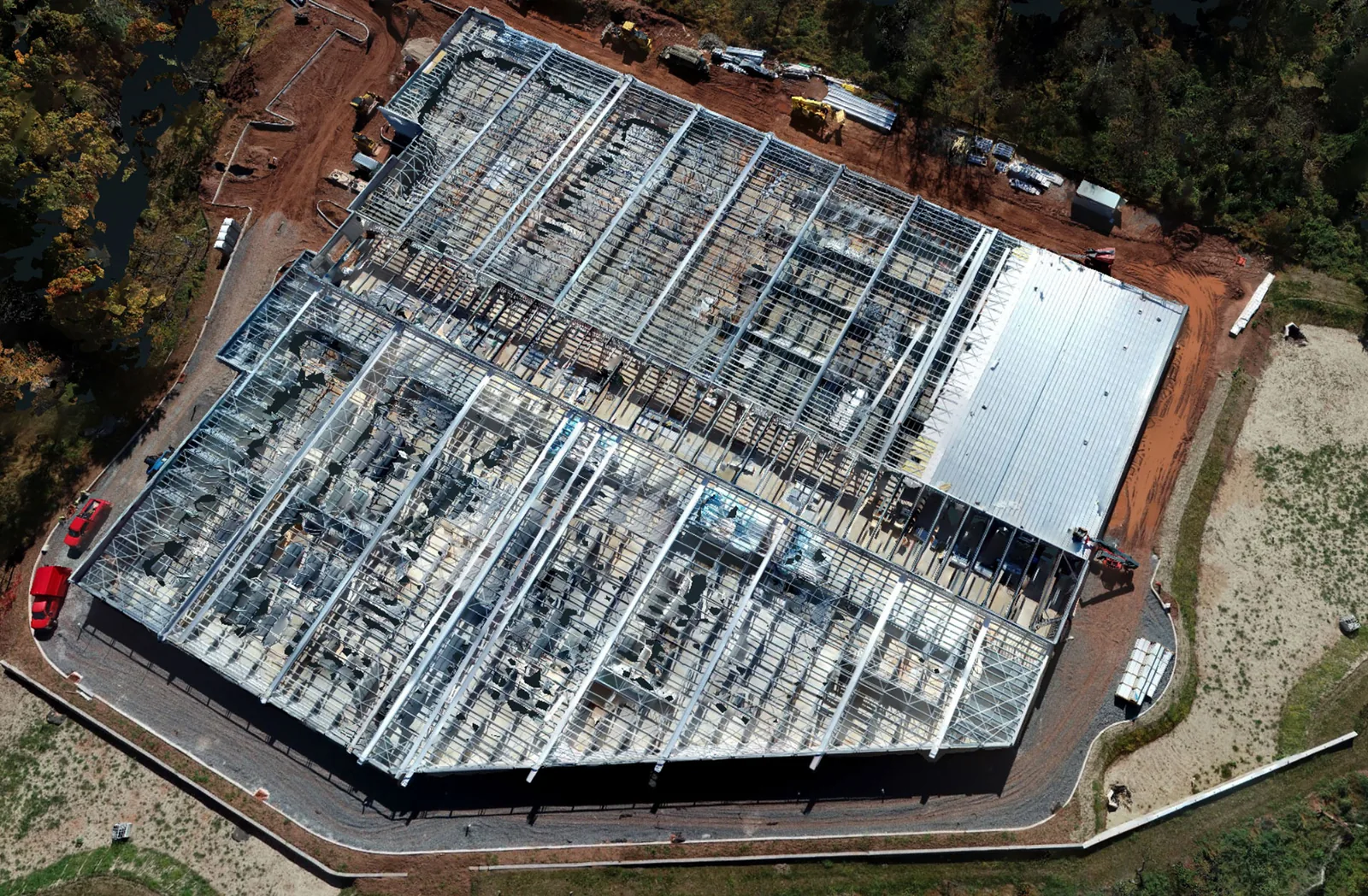
The crop below comes straight from the same orthomosaic, only partway zoomed in. Steel connections, slab edges, and the excavator are already clearly readable, which is what turns an aerial map into a working document: measure a footprint, check staging against the site plan, or confirm exactly what was on site the day of the flight.
Orthomosaic, elevation model, and 3D views
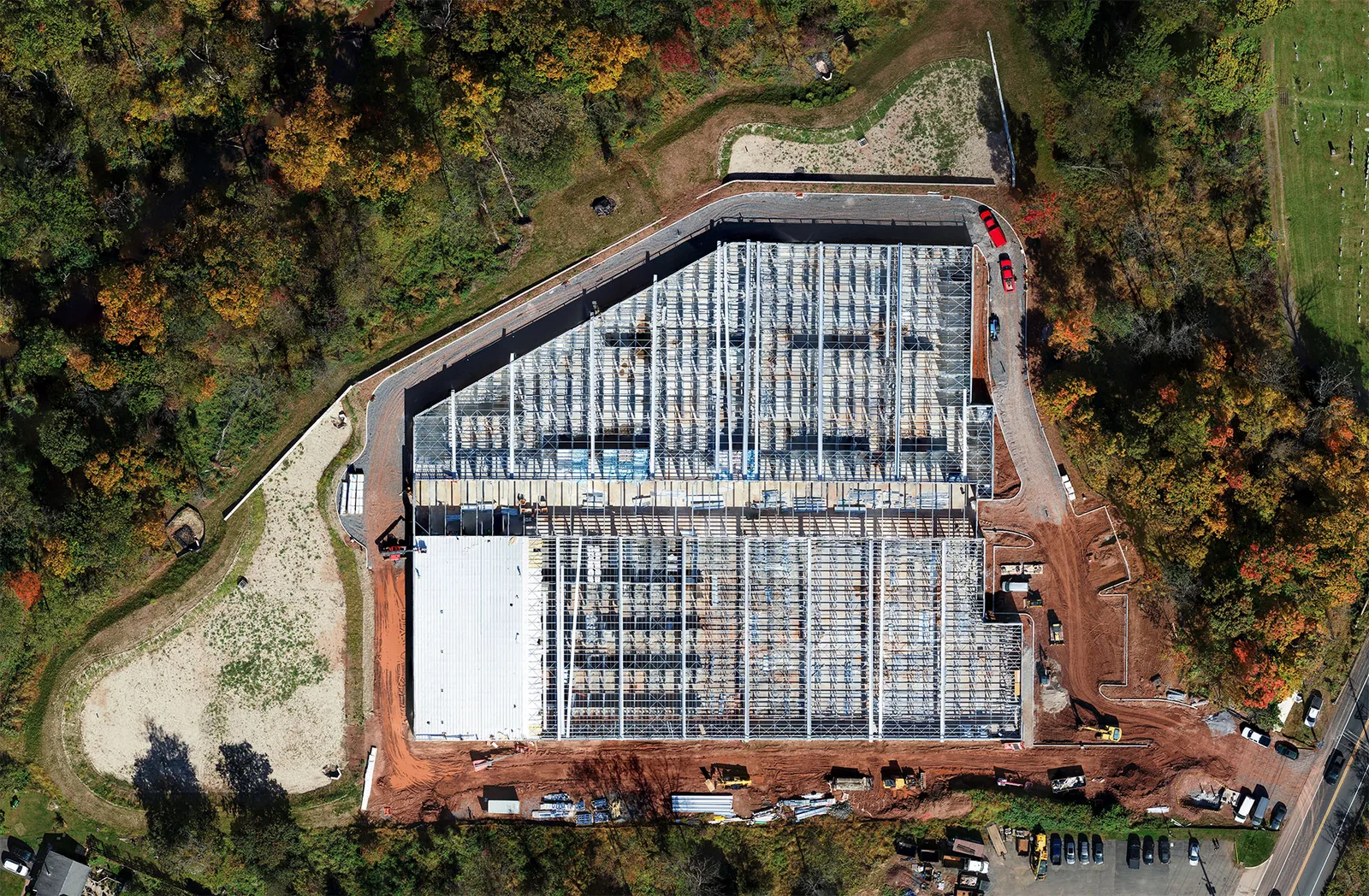
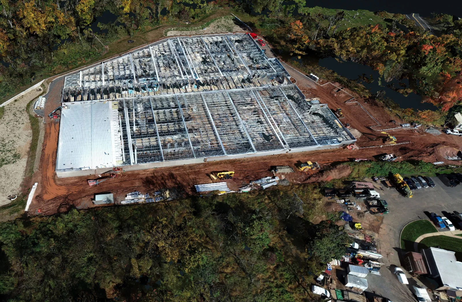
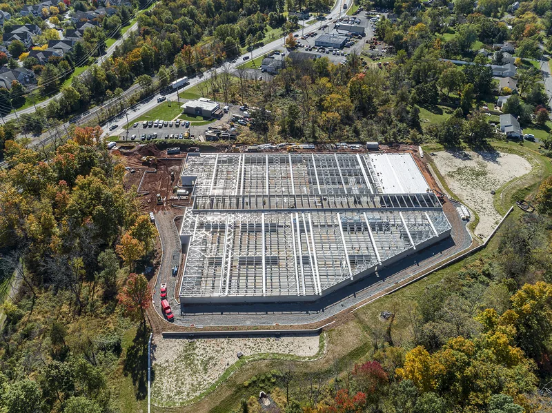
All six images come from the same Hillsborough visit: the orthomosaic, the elevation model, three views of the textured 3D model, and one of the marketing aerials shot before we packed up. Click any image to enlarge it.
How mapping flights are flown
Mapping flights follow an automated crosshatched grid with fixed image overlap and consistent exposure, planned before takeoff. That discipline is what lets hundreds of photos stitch into one accurate image, and it is why a re-flight next month lines up with this one. Sites inside controlled airspace near Newark Liberty, Teterboro, or Morristown get the FAA authorization as part of the job.
What project teams do with the map
Builders measure laydown areas and track progress between milestones. Lenders, investors, and municipal reviewers open the map at a link and see the whole site in seconds. Owners keep a dated record that settles questions later. Marketing teams pull the aerial stills from the same visit for brochures and pre-opening campaigns.
Drone mapping questions
What is an orthomosaic, in plain terms?
A single, to-scale aerial image of your whole site, stitched from hundreds of overlapping drone photos and corrected for lens and perspective distortion. It looks like a satellite view, but it is current and far sharper, and you can measure distances and areas on it.
How accurate is a drone map?
Standard deliverables are mapping-grade: accurate for planning, measurement, and engineering reference. When a project needs tighter tolerances, we add ground control points. A drone map is not a substitute for a boundary survey by a licensed New Jersey land surveyor.
What file formats do you deliver?
A georeferenced GeoTIFF for GIS and CAD software, JPEG and PNG versions for presentations and print, DXF or SHP contours for CAD, and PDF exports for sharing. Tell us what your team works in and we'll match the export.
How do stockpile volume measurements work?
We fly the yard and deliver a labeled map with the volume of each pile in cubic yards, plus tons when you give us your material's density. The method is identical on every visit, so monthly or quarterly figures stay comparable for audits and insurance.
Can you map an active construction site on a schedule?
Yes. We re-fly the same grid weekly, biweekly, or monthly, or at milestones such as clearing, foundation, steel, and enclosure. Because the flight pattern repeats, each map lines up with the last for side-by-side comparison.
How large a site can you map?
Anything from a one-acre commercial lot to a full industrial facility. Most sites are captured in a single visit, and if your deliverable has a deadline, put it in the quote form.
Get a drone mapping quote for your New Jersey site.
Tell us the acreage and what the map is for (planning, logistics, or marketing), and we'll scope the flight.